Parametric Urban Design Analysis with Spatial Insights
Posted on January 21, 2025 • 11 min read • 2,155 wordsUrban design via parametric analysis, optimizing spatial efficiency & sustainability

Enhancing Urban Design Performance: A Parametric Approach with Spatial Analysis
Introduction:
Urban areas globally are in a phase of rapid transformation. The population is growing consistently and so is the need for efficient, resilient and livable cities. These demands prompt urban designers and planners to embrace cutting edge solutions. They have to create effective built environments which serve the population in a sustainable way. This calls for an integrated approach to urban development where concepts like spatial analysis, accessibility, and land use are considered simultaneously instead of separately. The goal of this approach is to optimize land resources and create an effective urban environment using parametric tools and computational modeling.
The Need for Innovative Urban Design Tools:
Effective urban design involves careful analysis of many components. This analysis involves interactions between the buildings, roads, parcels and public spaces, along with environment’s role in the functioning of the overall urban environment. To better assist in dealing with urban areas’ organizational, sociocultural and environmental aspects, the use of the latest design and analytical techniques is essential. Urban development tools must have an iterative process where designs can be constantly verified to improve their effectiveness in terms of land optimization, sustainability and resilience.
For these reasons, analysis methods should consider daylight exposure, visual connections and accessibility. These parameters are essential to not only measure design performance but to assess human environmental needs. Applying spatial assessments at an early stage is key in creating robust approaches to urban growth which balance both ecological needs and societal aspirations. Many software solutions aid designers with planning, analysis and visualization tasks, they have a limitation of often executing these processes in isolated manners. Urban design software tends to create the form of designs and spatial software tools primarily investigate how that form behaves. For a deeper integrated and connected design solution there is a need to seamlessly connect both of these workflows. This would enable a flexible approach of combining the design elements with in-depth analysis simultaneously and reduce loss of information.

An Integrated Approach: Parametric Design & Spatial Analysis:
The need for connected analysis motivates an exploration in an integrated approach, using a flexible system which utilizes parametric design software such as Grasshopper. It operates as a powerful framework for combining several design concepts along with algorithms. It can allow the user to effectively design an urban plan. This begins with urban area export followed by processes such as generating a street grid system, delineating parcels, and establishing various types of building locations within a mixed-use area. The framework not only creates forms it can analyze, iterate and optimize all aspects in an integrated flow of processes.
Core Methodologies
The main part of an efficient approach is based on establishing a systematic urban morphology by employing key methodologies for establishing parameters for creating a functional, connected and efficient city.
- Street Networks: Starting from establishing streets, this utilizes a common model in urban design, known as the Manhattan grid system to structure the area into orthogonal streets. These streets are carefully laid out and create the foundational elements for connecting blocks and areas. This provides an ordered, structured network optimized for navigation, and also provides clarity within the layout.
- Parcel Design: Employing a Voronoi algorithm for parcel design gives a balance of irregular natural and highly adaptive plots for optimal layouts of individual areas. This spatial method goes beyond the aesthetic by enabling site-specific designs which conform to building standards. This carefully manages plot boundaries and orientation for functional purposes with environmental considerations taken into account at the design stage.
- Building Types and Criteria: Once we establish all the plots, these plots provide the foundation for planning the various types of structures and forms needed for all city operations. This begins by analyzing all standards and building parameters which provide key specifications, such as ground coverage ratios, number of floors, and site-specific locations within city masterplans. These specifications, along with various metrics, allow an integrated process which ensures each type of structure meets set parameters and can function at an optimal level for both their internal operations and integration within the larger city infrastructure. This includes specific design rules, metrics related to space requirements, functional layouts for operations and how each space fits within an operational structure. This provides more effective use of space while balancing all human and resource needs within set environmental conditions.
Spatial Analysis Methods:
Once designs have been proposed and an optimized scheme has been achieved the process needs to use multiple metrics which evaluate how these spaces work in a practical and real way.
- Accessibility: To gauge the ease with which the various parts of the city are connected is vital in how well they operate for human needs and activity. Metrics such as “betweenness centrality” assess how frequently an element is on the shortest paths between the nodes of the transport networks while the closeness centrality describes the total average distances in between those networks, indicating places easily accessible to everything in an efficient manner. By applying these analytical approaches they can evaluate street networks effectiveness while at the design stage for better solutions in planning.
- Visibility: It is equally critical to analyse visibility for environmental awareness in the public spaces for ease of navigation in different areas. Based on a mathematical representation, each view or isovist, shows areas and shapes from certain locations that may be seen with an overall analysis giving detailed and robust insights. It gives quantitative measurements like area, the distance covered along the edges as perimeter, or compactness showing visible locations from various perspectives of city blocks and the surrounding environment. With all the considerations taken this allows us to prioritize design strategies for open visibility spaces and ease in overall orientation and better wayfinding in any given situation or area.

A Practical Case
To prove the methods outlined above an actual project can serve to see the power and practicality of these spatial technologies applied to the development of Ben Guerir’s Green City in Morocco. By integrating actual parameters such as geography, environment and the intended scope for the site it becomes possible to utilize these tools and techniques into creating efficient urban plans.
This study specifically evaluated an urban plot of land spanning approximately 29.5 hectares in the heart of the Green City. The case of Ben Guerir is especially interesting due to it’s vision for innovative environmental, technological, social, economical development and this analysis helps test a flexible and adaptive urban planning approach which ensures long-term city resilience.
Implementation Steps and Software Details
The development process started with the deployment of tools to import city boundaries to map parameters of the proposed urban layout. Following the initial set up and using algorithms the model systematically laid out street networks based on the established standards. The model subsequently utilized Voronoi algorithms to divide the spaces into useable lots, balancing the need for spatial optimisation and efficient use of all the land area while integrating all functional requirements. After this phase multiple architectural parameters were implemented. With all building blocks laid out they followed zoning criteria specified within guidelines and created structures based on their types. Once layouts and functional zones were complete spatial analysis was used which included accessibility and visibility evaluations which were assessed as key components.
For detailed analyses of these metrics different tools such as decoding space tools were used with specific computational calculations of accessibility of betweenness and closeness within the city. These tools showed street paths to create maps for highly accessed pedestrian movement routes as an overall network assessment. All these results indicated areas which could create the optimal infrastructure for better traffic management by better flow, easy and open access between places in all zones. Following accessibility mapping, an extensive investigation of visibility was assessed based on analysis that included area, compactness perimeter etc. It is also notable that to develop all urban modeling Grasshopper was connected to Rhino. For modeling environmental performance DragonFly is implemented and Ladybug components provided thermal modeling outputs. These included lighting daylight autonomy parameters and shading simulation in real world conditions. These are then compiled within comprehensive results.
Insights into the Application Process
Within this methodology after establishing core areas and components detailed simulation can proceed with detailed environmental simulations to enhance optimal urban form selection.
Energy Modeling: By incorporating elements such as material type, thermal transfer parameters, building function and window size into the computational design process enables precise evaluation and detailed modelling for total environmental effects. This enables energy performance evaluation and a greater reduction in carbon emissions which is key to overall city function. Simulation parameters include thermal behavior and other aspects using a ‘bottom up’ modeling strategy. By calculating building parameters and thermal performance at an element level it produces a holistic understanding for design at an urban level. Results then provided data of total cooling demands, peak energy consumption with detailed simulations of internal day lighting capabilities. By including key insights from simulations it guides building locations, types, orientations as per environment requirements.
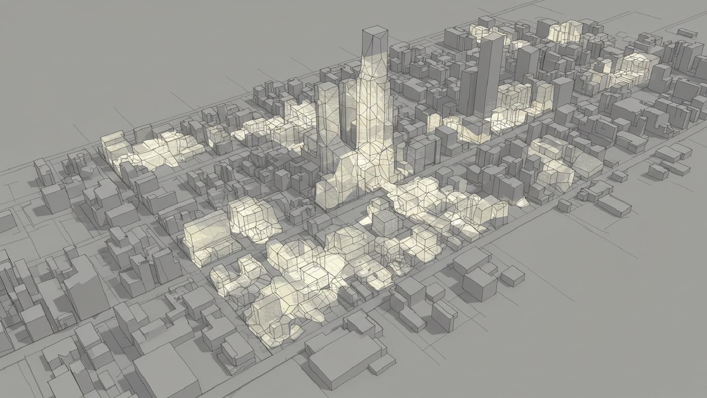
Optimizing Location Selection After carefully running several simulations we were able to show an equal distribution of sunlight within single-building type categories, such as public spaces which indicated an uniformity within performance with regards to thermal properties irrespective of their placement. Given these conclusions spatial analysis is particularly important in evaluating the key aspects, and so they guide overall layout choices within cities as design elements within public places. These observations can inform a selection method using urban layout methods for placement rather than relying on external analysis and design based considerations as metrics to decide positioning of elements. These detailed analytical and spatial analysis aspects work with local zoning rules.
Key Results:
These findings validate an integrated urban design with performance metrics using sophisticated methods and metrics and these result in various outcomes for planning and policy in development of smart cities:
- The use of a Manhattan Grid, alongside an innovative Voronoi-based parcel approach has enabled optimized use of the site plan with better connections while maintaining key building form qualities and efficient movement between points of activity.
- Simulation driven designs produced well-defined metrics which showed a standard performance, with optimal day lighting capabilities along with balanced cooling, heating profiles that ensure maximum usage.
- Analysis of access and view show that the model gives improved routes to facilitate way finding, better user experience along with improved pedestrian flow. This increases area visibility while at the same time allowing intuitive navigation by improved spatial and user oriented urban plans.
Challenges and Future Developments:
Although the work delivers good findings there are several limitations that can be addressed by further future work. Accuracy of data analysis hinges upon the robustness of input quality which includes detail for existing parameters within each zone and urban data analysis aspects, any gaps within input leads to inaccurate and poor designs that should be avoided. The framework must be able to represent different variables by incorporating the most current environmental metrics of human behavior or more robust, sophisticated models and tools. More work and case studies need to be undertaken which further test different and more complex cities with various geographical zones to expand overall system adaptability. This provides a basis to include important factors, specifically in under represented zones which provide better policy guidelines. Future systems may utilize real-time feedback through sensors, artificial intelligence and other smart urban solutions, these would allow much more flexible models to inform robust planning. It also ensures continuous and efficient sustainable growth with inclusive equitable systems of all groups that provide long term advantages within every type of urban fabric.
Implications for the Future of Urban Management:
To summarize, an automated decision-making strategy was established in this study that is useful for better, modern, efficient and more robust city plans for sustainability and long term use. By utilizing advanced data processing tools urban designers, planners are well-placed to use innovative technologies within robust decision frameworks to guide effective sustainable human based built environment. This shift can promote overall better quality within both natural and urban fabric, while making long term sustainable growth strategies easier to implement within future design. These detailed planning metrics would also give key aspects on policy for improved spatial usage as a critical parameter within our urban world that addresses current and upcoming complex requirements.
Conclusion:
An integrated and analytical technique for urban design proves extremely practical in generating effective spaces which address social needs, resource management and overall sustainability. It offers an avenue to build adaptive, resilient urban areas, by integrating powerful and versatile planning, analysis, modeling tools which also enhance efficiency, connectivity and all metrics needed within complex, modern city contexts. By using tools such as spatial analytics we can design not just functional places but sustainable and resilient environments which meet today’s human requirements as they become even more demanding for a planet in change.