Geospatial Analysis of Urban Space Vitality: Blue-Green Spaces and Geographic Detectors
Posted on January 24, 2025 • 8 min read • 1,700 wordsHow geospatial tech & big data enhance urban blue-green space vitality. Learn spatial analysis for better cities
Enhancing Urban Vitality: The Geospatial Dynamics of Blue-Green Spaces
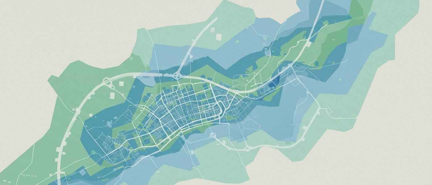
The character of a city is often shaped by its open spaces – those parks, rivers and lakes where people go to connect with nature. These “blue-green” spaces aren’t just aesthetic additions; they are essential drivers of urban vitality which have measurable impact on both community wellbeing and public health. In recent years, researchers are exploring ways to not just create these spaces but to actively optimize their influence by understanding their underlying mechanisms with spatial analysis. Let’s take a look at some of those methods using big data to help with urban planning.
Quantifying the Intangible: Measuring Spatial Vitality
Traditionally, the study of urban spaces often relies on manual observation methods or coarse statistical models. These methods are inadequate when studying complex relationships between activity levels and built and natural environment in a systematic way. But now, we can use spatial datasets such as Location-Based Services (LBS) data collected from mobile devices. With a growing interest in precise assessment of city spatial dynamics, such data helps to analyze, at a fine grain level, what areas draw people in, and conversely, what spaces fail to captivate public engagement. This ability to quantify how frequently and consistently people engage with blue-green spaces introduces new perspectives in our understanding of human interaction with these urban assets.
Spatial vitality isn’t a monolithic thing but a composite of intensity, stability, and variability. Intensity quantifies the level of use in an area: the sheer volume of visitors going to a specific location over time. This intensity represents an initial evaluation of spatial value. But consider places where crowds are inconsistent, such as areas popular at midday, and vacant on evenings. To help evaluate this we must study spatial stability, by quantifying how much of a pattern persists over longer intervals and across time. This reveals the enduring appeal of an area. Finally spatial variability refers to how a particular areas’ engagement varies within the day. High variability indicates an area has some periods where it draws more or less foot traffic. Understanding each of these individual components provides insights to the dynamics behind spatial vitality. And if the location, over longer period of time attracts more foot traffic than usual, that suggests its impact over spatial context is growing. In this way, quantitative indicators act as building blocks that capture a wide scope of social dynamics and make them directly useful.

External Factors and Their Role
When considering factors that affect the vitality of urban blue-green spaces, most analysis typically explores site-specific qualities: things like size of park, shape index and quality of facilities. However research consistently demonstrates that external factors have stronger links to actual visitor count than internal elements do. Accessibility of a space from major transportation arteries and its functional integration with city become vital for driving overall vitality. Let’s dive in, and explore each of them more specifically:
Accessibility:
It goes without saying: getting to these places needs to be easy and safe. But that concept actually contains several layers that affect real-world experience. This concept is broken down to walking accessibility and access to public transportation:
- Walkability: Refers to distance from nearby neighborhoods. This concept reflects ease of access for residents on foot. Spaces which encourage shorter distances can effectively invite community interaction and increase area foot traffic.
- Public Transportation Access: Proximity of subway and bus stations affects public space usage as well. Public transit networks can attract residents outside of the immediate walking radius which, for large areas is incredibly significant. These kinds of connections also increase efficiency and sustainability within the area, because more people can benefit with access.
Spatial Function and Integration:
Urban blue-green spaces should exist, but they shouldn’t feel divorced from their setting. A mixed area promotes better utilization because a variety of spatial and economic activities exist near those blue-green spaces. Those include things like: * Residential Spaces: High-density areas within close vicinity of natural features and parks can dramatically influence public engagement in open areas * Commercial Spaces: Places near work offices and consumption places enhance vitality of urban parks because their residents work or visit those local places too. Therefore diverse places nearby make the public visit such spaces as well.
The mixing degree is also an important indicator: diversity and functional integration promote a dynamic local environment and lead to stronger space utilization rates. These integrated areas ensure an accessible social environment which has a direct positive affect on public well being.
Demographic and Economic Context:
In addition to structural connections, local area economics and demography must also be accounted for.
* **Population Density**: Higher density correlates to greater potential public involvement in available area amenities
- Regional Economy: Wealth influences availability of accessible places, and areas that provide adequate income generate better visitor experience by enabling better public and transport services. Areas with more affluent neighborhoods may generate more and higher value service and maintenance which also improves experience for the visitor and generates demand.
Synergistic Effect: Exploring Factor Interaction
It would be useful to know exactly how the different factors, alone or in conjunction, actually contribute to spatial vitality. Because urban systems are highly interdependent it is imperative to investigate their combined affect. As you can imagine factors influence each other and how those factors function simultaneously may be a significant consideration, leading to outcomes beyond just the influence of their individual contributions. For example how a site accessible for walkability may not generate much visitations, whereas having access to commercial, residential and public transport areas is proven to impact such open space positively and generate positive spatial usage. Such interconnections reveal more effective strategies for leveraging spaces within city planning initiatives. For example public transportation when interacting with areas of commerce may reduce positive use within that space because such an influence pulls visitors elsewhere in city, leading to nonlinear effects that are otherwise absent during individual analysis. The best interaction result occurs when there’s a mixed residential setting, high accessibility, strong local economic opportunity that leads to best overall results in terms of overall spatial usage within parks and blue-green space areas. This “catalytic effect” illustrates that the combined factors do matter and their total effects may become much higher than if we tried evaluating their influences separately. Understanding these connections is very beneficial to city planning process, as that information highlights what interventions, if combined would yield best returns for effort.

Methodology: Analyzing Spatial Factors Using Big Data and Geographical Detector Methods
So, the question might now be how do we understand these different parameters at city level, and integrate it effectively in to urban planning. A specific approach using geospatial big data combined with geographical detector methodology opens ways for new forms of urban planning, allowing cities to identify key driving variables related to spatial vibrancy and to determine impact on how well each one contributes.
With data from LBS and GIS sources as the foundational datasets we can create accurate models. GIS is an essential tool in this approach as spatial visualization and mapping enable planners to see patterns and distribution within an area that can then help create models to represent their underlying social influence. LBS provide data by indicating people densities, temporal use, which offers crucial input for assessing space performance over a variety of times in day and weekdays vs weekends, offering rich, granular assessment of use patterns which has not been readily available in past using old observational methods. Using Geographical Detector, a powerful statistical tool based on spatial analysis of variability of values across area, one can investigate what environmental elements consistently influence spatial characteristics such as space vitality. GD, uniquely designed for geographical analysis, detects relationships, as opposed to correlation in traditional approaches. Its statistical power is quite high even with lower sampling rate, and avoids multicollinearity issues commonly seen when studying factors such as urban planning. This approach, which can test both single influence and interactive combinations enables assessment with confidence when measuring complexity of city patterns. All these capabilities, combined provide a sound and thorough system for exploring urban data to generate effective results when it matters to maximize resource use within the area.
Implications for Planning and Urban Management
Urban river, and lake fronts are spaces within city where nature interacts directly with urbanity and are incredibly significant locations for planning interventions. Enhancing local functional areas and improving access through well designed pedestrian areas has high overall yield in such an implementation process. Cities can leverage combined data analysis approach to promote integrated and vibrant urban living and that starts by: *Prioritizing mixed-use designs, ensuring blue-green spaces connect to high activity areas within surrounding environment, and *Increasing and improving accessibility by designing robust pedestrian systems in these public areas along with easy public transportation All those interventions can positively enhance usage levels in city centers and optimize return of available public infrastructure for a given cost. And ultimately using all such information and strategies, planners should emphasize creating areas that are not only physically but also socioeconomically active as those parameters can generate vibrant areas beneficial for all public stakeholders. This data based method of designing the city increases overall vitality, optimizes public spaces and leads to city infrastructure growth, ensuring cities grow sustainable.
Future Scope and Closing Remarks
This field remains one that is full of potential. Some limitations persist within studies in that most readily available data are specific to those aged 15-60, requiring incorporation of diverse demographic groups in studies using alternative approaches for robust assessments. Also availability of complete public infrastructure data also limits fine grain insights when evaluating an area. For urban planning to improve we need more data availability from the public domain. Overall those parameters must improve in tandem. As geospatial technologies continue to grow there should be a more robust strategy for incorporating its value at city design initiatives so that planners can use tools effectively to drive better outcome with existing resources within the area. By applying data-driven insights and using combined multi variable methods with big data, planners can drive better and healthier more equitable communities for a vibrant city environment.